![]() Updated
by
PolicyMap
Updated
by
PolicyMap
Once you have zoomed the map to your location, added the datasets to display in the area, and made any customizations to the data layer or filters to data points, users can save a copy of the maps.
Public Edition users can use the screen capture function on their computers or mobile devices to save an image of the data and maps on the screen.
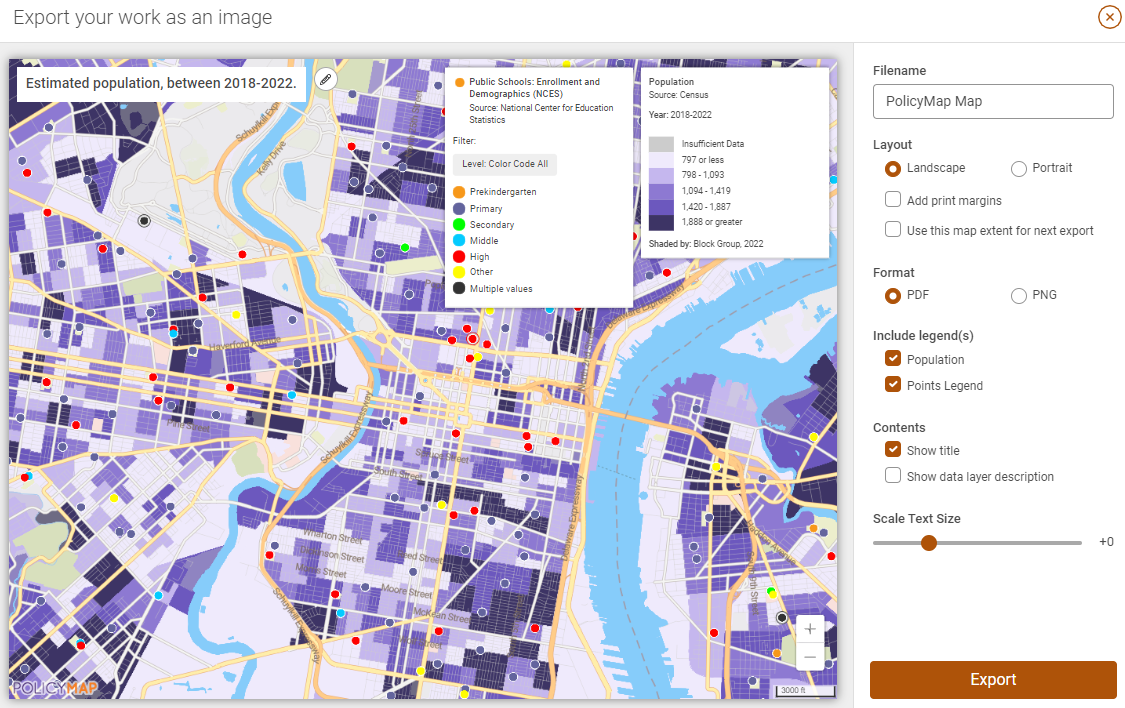
Subscribers can use the Print icon  to open the unique printing modal. Printed maps will popup as an alert for users to download directly. The model (below) gives users a variety of ways to customize the exported map;
- The map itself can be zoomed in and out or panned around. Please note, the image in the map modal is exactly what will be exported
- Legends in the preview window can be moved
- Edit the map title
- Rotate the map from a horizontal image to a vertical image
- Add/Remove margins
- Decide which export format is best for your use; PDF or PNG
- Add/Remove map details like the legends, description, or title
- Scale the text font size