Making a Custom Region
![]() Updated
by
PolicyMap
Updated
by
PolicyMap
Custom regions allow users to create unique boundaries on the map, and then build reports or download data for those areas. To use these features, click Custom Regions above the map and choose one of the three (3) types of custom regions: Drawn, Assembled, or Radius.
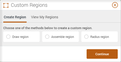
- Drawn region allows users to draw boundaries that can follow streets or landmarks freely.
- Assembled regions allow users to combine boundaries already in PolicyMap to form new boundaries.
- A radius region is a simple radius around a given point on the map or address entered.
When saving a custom region, users can give the regions a name, description, option to share with others, transparency of the fill-in color, and color of the region.
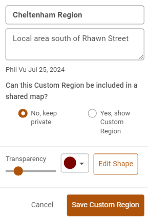
All saved custom regions will be available in the custom regions menu under View My Regions. Users can load custom regions, share regions, or even delete a custom region.
Users can edit custom regions that have been saved. Open a saved custom region from the View My Regions menu, expand the info bubble, select the Edit icon, and then Edit Shape.