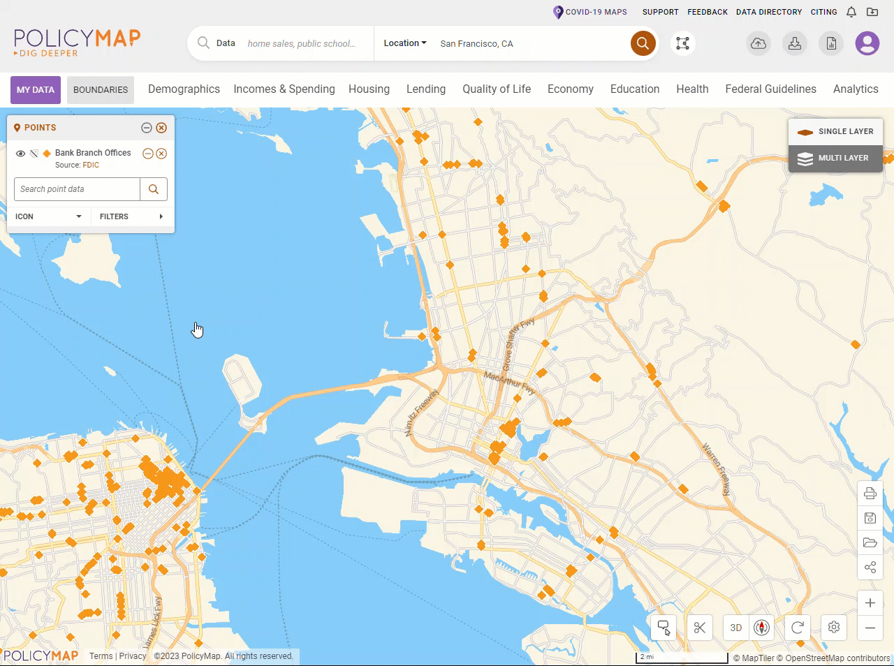
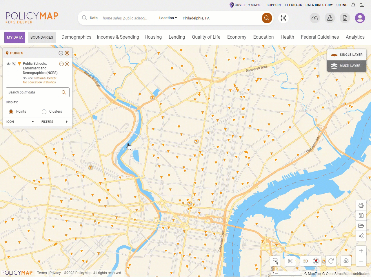
Points Legend
![]() Updated
by
PolicyMap
Updated
by
PolicyMap
Points allows you to view point datasets, like addresses, on a map. You can view these datasets by themselves or on top of a data layer.
When you load a point dataset, the Points legend will appear. The legend will display what icon the dataset is represented on the map, the optional ability to search, and the filter points. Click on any icon to display information about that site in the info bubble.
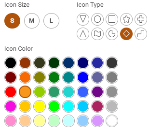
- Users can customize the color, shape, and size of any point dataset.
- Filter datasets: To filter, select the filter points button . The map will refresh and a subset of the dataset will now appear on the map. You can apply multiple filters to any dataset.
- Multiple filters can be applied at the same time, simply keep adding the filters.
- Adding filters from the same category is an OR query.
- Adding filters from different categories is an ADD query.
- Some filters have unique color coding options.
- You can remove any site dataset or a filter(s) by clicking the X symbol next to the name.
- Use the icon
 to add and remove the label for each address on the map.
 - The search field is a simple keyword search for the point dataset. The field searched varies between point datasets, but generally it will be the address name. The query is based on the extend of the map, so it will only show results for addresses that are within the current view of your map.
- The search field can also be used to query points based on the name to title of the points dataset.
- Add multiple point datasets to you map: Simply click on each one you wish to add from the menu.
The legend can be dragged to any location on the map. Select the bar on top of the legend to select, and then drag. The (--) symbol on the right will minimize the legend, which will be replaced by an (+) to maximize the legend.