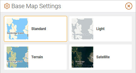
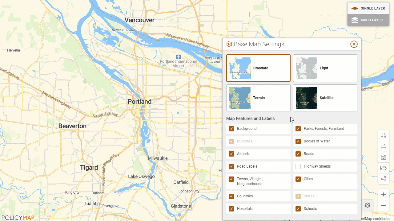
Users have the ability to customize the information shown on the underlying maps including street names, town names, land cover, water labels, roads, and more. The base maps can also be changed to other unique layers like satellite maps, terrain, and lighter shade.
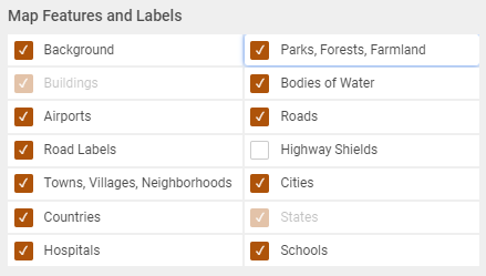
The Map Features menu allows users to add or remove some underlying information on the base maps. This will help manage how much information a map will display.
Background - The underlying background coloring of the base map
Parks, Forest, Farmland - This is all greenland
Buildings - Building projections and shapes. The building layer is only available zoomed into the map.
Bodies of Water - Oceans, rivers, bays, lakes, and any body of water
Airports - National, regional, and local airports.
Roads - All highways and roadways
Road Labels - Street names
Highway Shields - Shield labels for highways, expressways, and routes
Towns, Villages, Neighborhoods - Smaller towns and neighborhoods
Cities - Major and micro metropolitan labels
Countries - Labels for US and other countries
States - State labels
Hospitals - Hospital locations
Schools - Location of elementary, secondary, and university/college
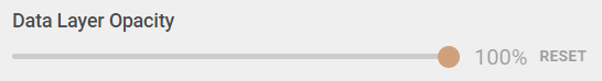
Control the transparency of a data layer on top of the base maps.
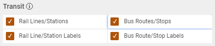
Rail Lines/Stations - Rail Lines include freight and passenger lines. Zoom in closer to see a slight color difference between local and national lines.
Rail Line/Station Labels - Zoom in closer to see station locations and labels. Freight lines will not have stops or labels.
Bus Routes/Stops - Bus Routes included local transit, shuttles, and varying bus services.
Bus Route/Stop Labels - Zoom in closer to see bus stops, labels for stops and routes.
For more information on the Transit data, select the
Users can change the underlying base maps and select from a lighter base map, terrain, or satellite. Please note, the Map Features and Labels options will vary according to a Base Map selected.