Data Loading and Geocoding Part III: Using Coordinates
![]() Updated
by
PolicyMap
Updated
by
PolicyMap
In our past two posts on geocoding in the data loader, we talked about how to correct incorrect addresses after loading points. But what do you do if you can’t get an address, or you can’t get the geocoder to find the address?
Let’s look at the Coatesville Area Public Library in Coatesville, PA. To find where this is, we’ll have to use another online mapping system.
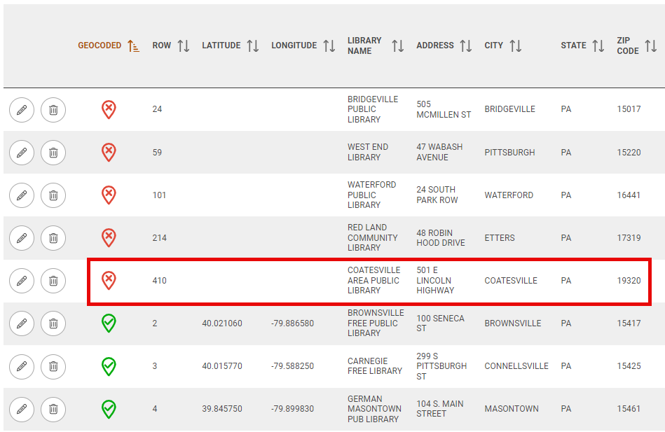
Mapping websites like Google and Bing offer good solutions for finding specific places in the world. PolicyMap on the other hand, is good at telling you about a place with data but we are not always the best option for finding a specific address for establishments. We will use Google Maps to find the Coatesville Area Public Library in this case.
To add the address to PolicyMap, we will need the latitude and longitude coordinates. You will then enter the new coordinates for each address in the Review Uploaded Data in the Data Loader tool. Here are the steps:
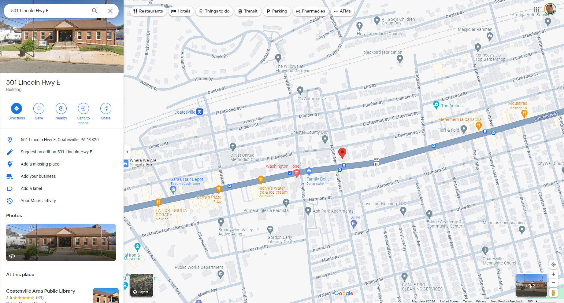
1. We will go to Google Maps and enter the address of 501 E LINCOLN HIGHWAY, COATESVILLE, PA. According to Google, the Coatesville Area Public Library is right here:
2. In order to display the library on PolicyMap, you need to get the latitude and longitude coordinates. It might sound daunting, but it is actually really easy. Right-click on your mouse at the base of the point on the map, and you will see the latitude and longitude coordinates in the info bubble.
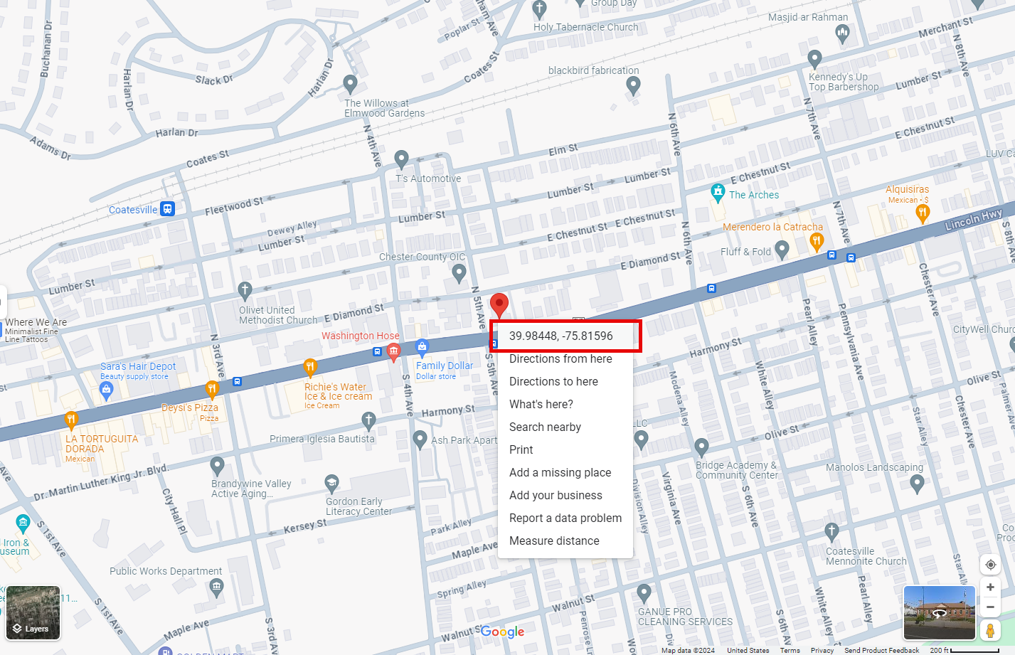
Note that the coordinates appear with the latitude first, followed by the longitude. Select the "lat/long" from the bubble to copy. You will need to separate the latitude and longitude manually, as the copy will contain both.
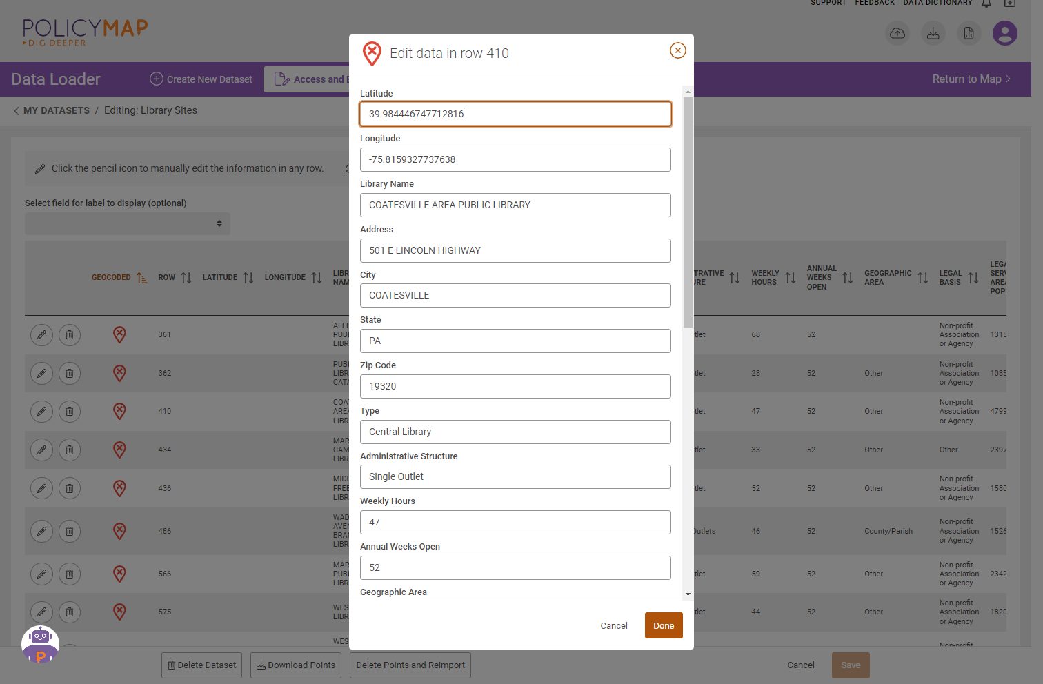
3. Open the dataset in PolicyMap and select Edit Points (in case you do not already have this open). Select the pencil icon  to edit the address, and paste the coordinates saved on the clipboard into the latitude and longitude fields.
4. Repeat these steps for any addresses not found by the PolicyMap geocoder.
It might seem like a lot of steps, but it’s not very difficult. Once you are done, you will have all your points on the map. Do you have any geocoding tips to share? Let us know by leaving a comment or sending us an e-mail.