Data Filters
![]() Updated
by
PolicyMap
Updated
by
PolicyMap
Users can add filters to their uploaded point datasets when using the Data Loader. Filters allow users to display certain subsets of their point data on the map, and offer several key benefits that enhance user experience, improve decision-making, and streamline finding relevant information. Here are some ways that users can benefit from filtering their points:
- Filters allow users to personalize the display and understand where certain subsets of their points are located
- Users can compare locations within or between specific categories
- Users can filter by multiple categories at once to easily identify which of their points meet certain criteria, and see where those points are located
The heading of each column of data from the uploaded file will be listed at the top of the Add Filters screen. Users can then select which of those columns they would like to create filters for, by toggling them on or off. Once you toggle on a column, the filter will appear in the filter menu below.
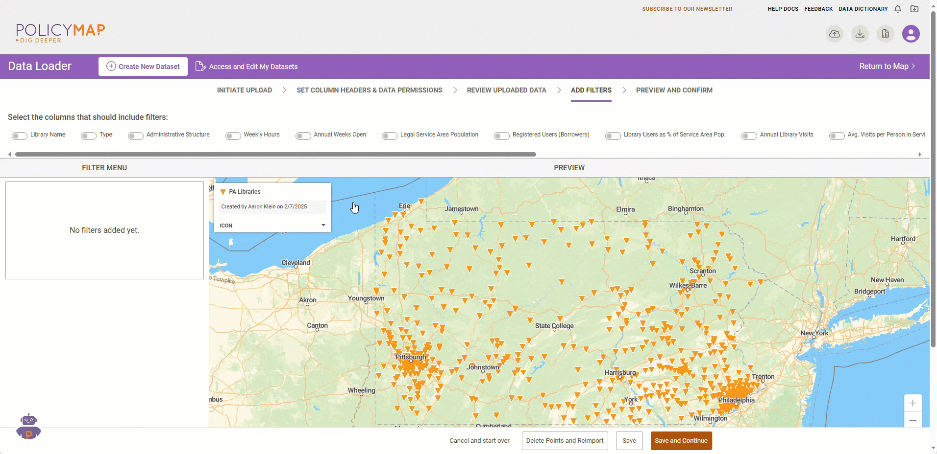
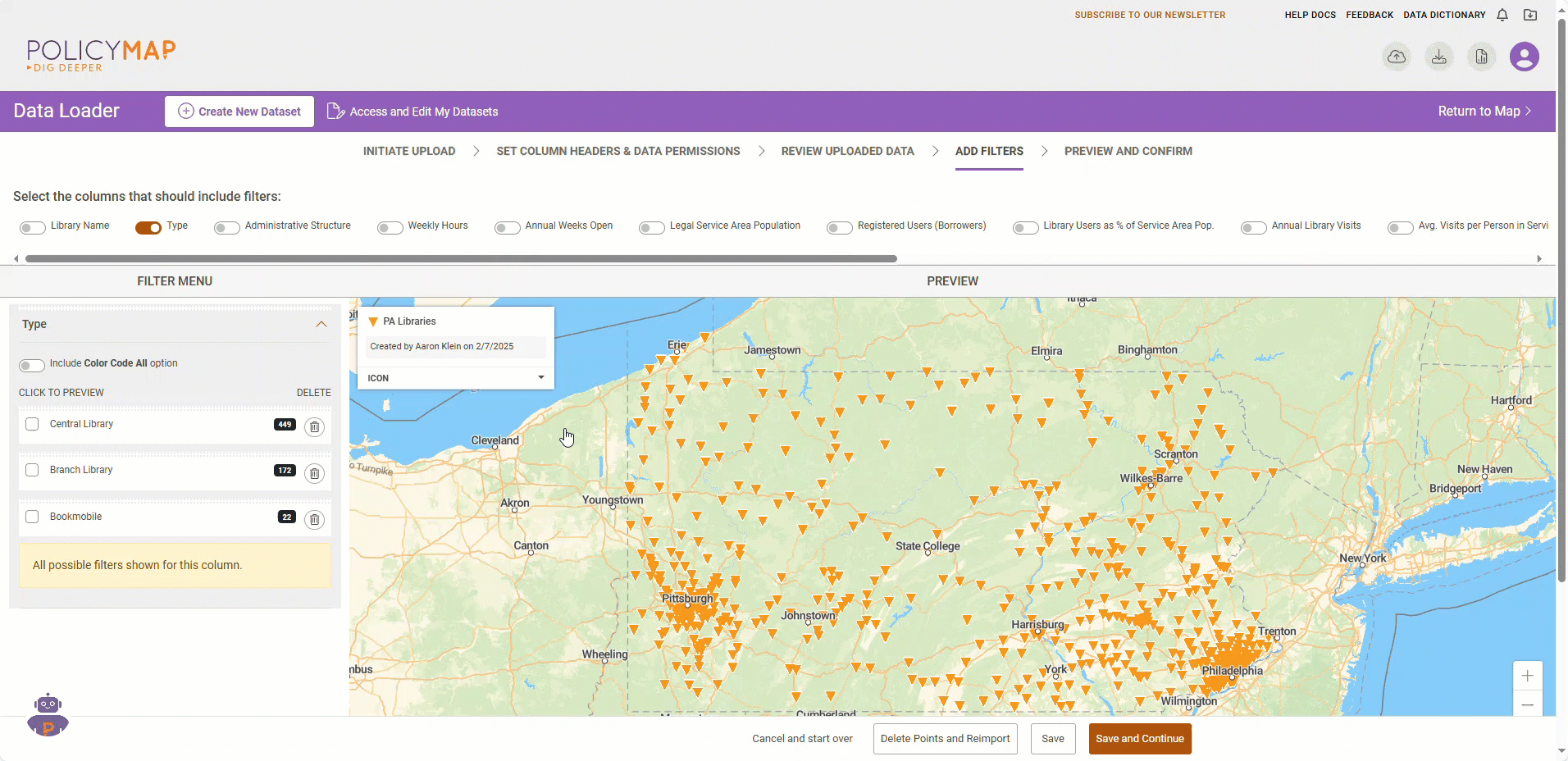
Filters can be created for two different types of data: categorical and numeric
Categorical data represents types of data which can be divided into groups. In this example, library type is a type of categorical data, as it can be divided into central libraries, branch libraries, or book mobiles. The filter menu will list each category of the data and will also display the total number of points that fall into each of those categories.
Numeric data includes any data that is presented in the form of numbers. In this example, Legal Service Area Population is an example of numeric data. For numeric data, users are able to change the number of ranges and even the cut points for each range.
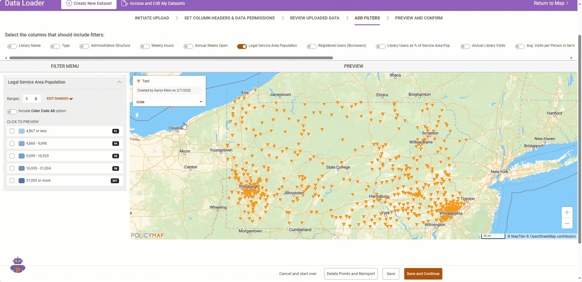
Users can also choose to include a unique color code option which will assign a different color for each type of point, allowing users to easily distinguish between them on the map.
The preview map will allow you to preview each filter before saving and advancing to the next screen.