Custom Region: The 50% Rule
![]() Updated
by
PolicyMap
Updated
by
PolicyMap
When data for a custom region is aggregated in a report, data from smaller geographies within the region is used to calculate the values for the custom region. For drawn and radius custom regions, PolicyMap automatically chooses which type of smaller geographies to use in this calculation based on the geography availability for the data and size of the custom region.
Large custom regions may have aggregated data comprised of counties, whereas small custom regions may have aggregated data based on census tracts. Not all indicators have data for all geographies so, in some instances, the geography type will not be OR may not be exact fit.
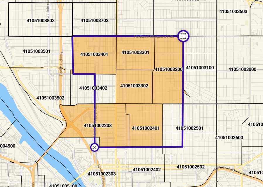
Drawn custom regions or radius regions may not line up with the existing geography boundaries. In some cases, a few boundaries may be mostly inside the custom region, but partially outside. Boundaries may be mostly outside the custom region as well, but poke into it.
For a boundary to be included in the custom region aggregation in a report, at least 50% of the boundary must be contained within the custom region.
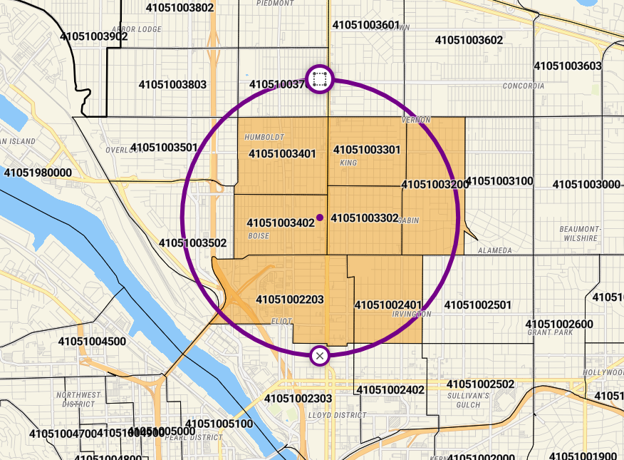
In the first example, only the orange shaded census tracts (41051003401, 41051003301, 41051003402, 41051003302, 41051003200, 41051002203, and 41051002401) would be used when aggregating data. While tracts (41051003501, 41051003502, and 41051003702) do not have at least 50% of their area contained within the radius custom region.
In the second example, we have drawn a custom region following streets but these streets do not correspond to census tract boundaries. Because of the 50% Rule, our custom region will use the orange highlighted census tracts (41051003401, 41051003301, 41051003302, 41051003200, 41051002203, and 41051002401) when aggregating data, while tracts 41051003402 and 41051002501 will not be included, since less than 50% of those areas are contained within the custom region.