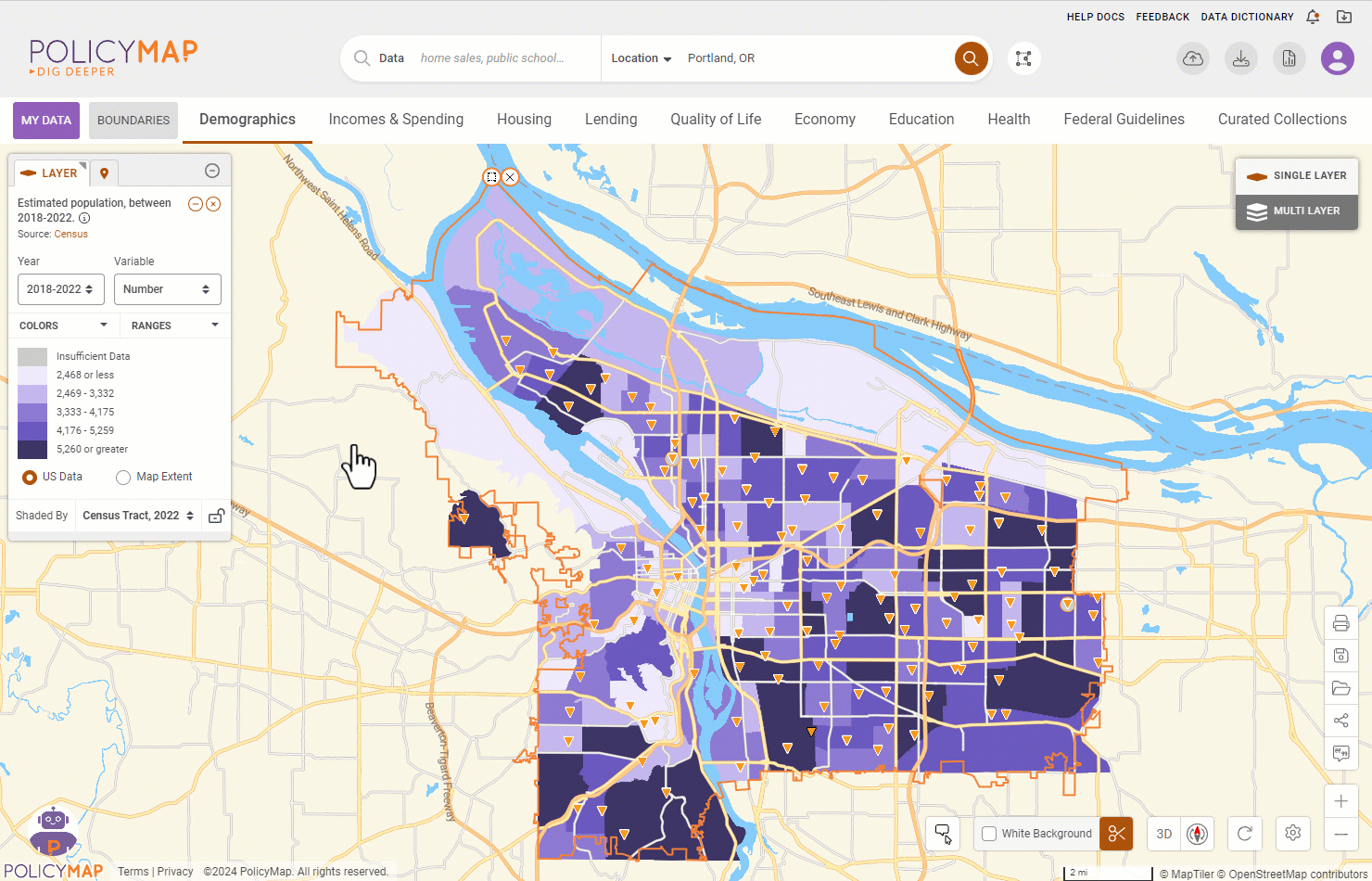
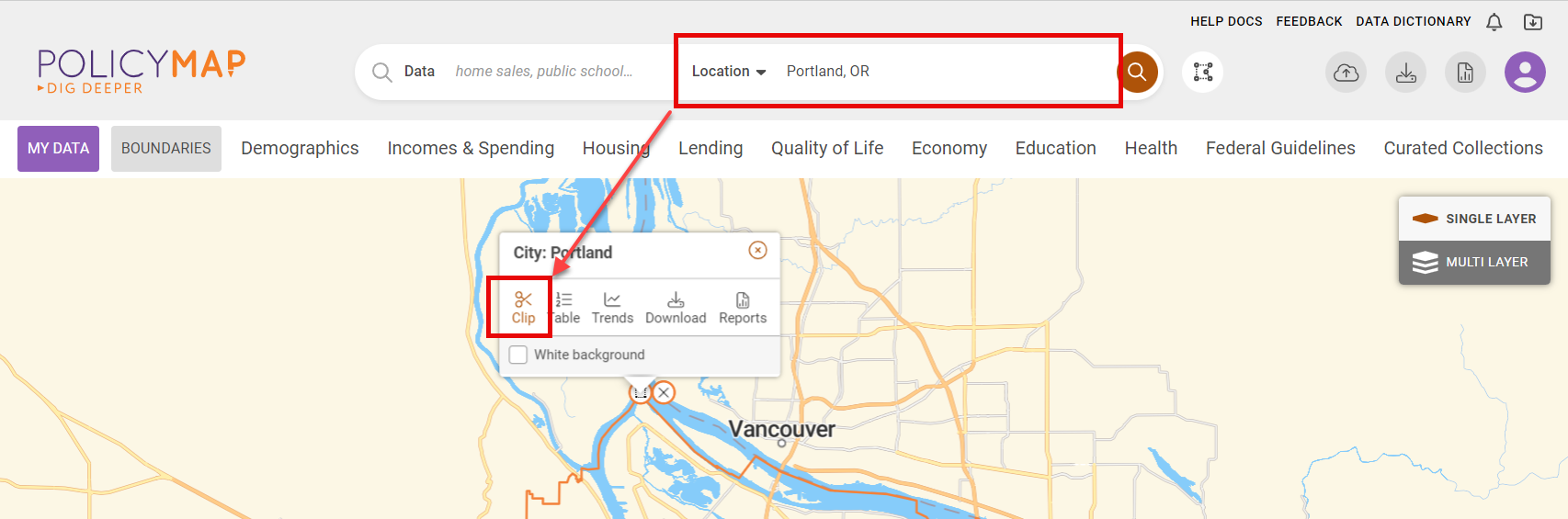
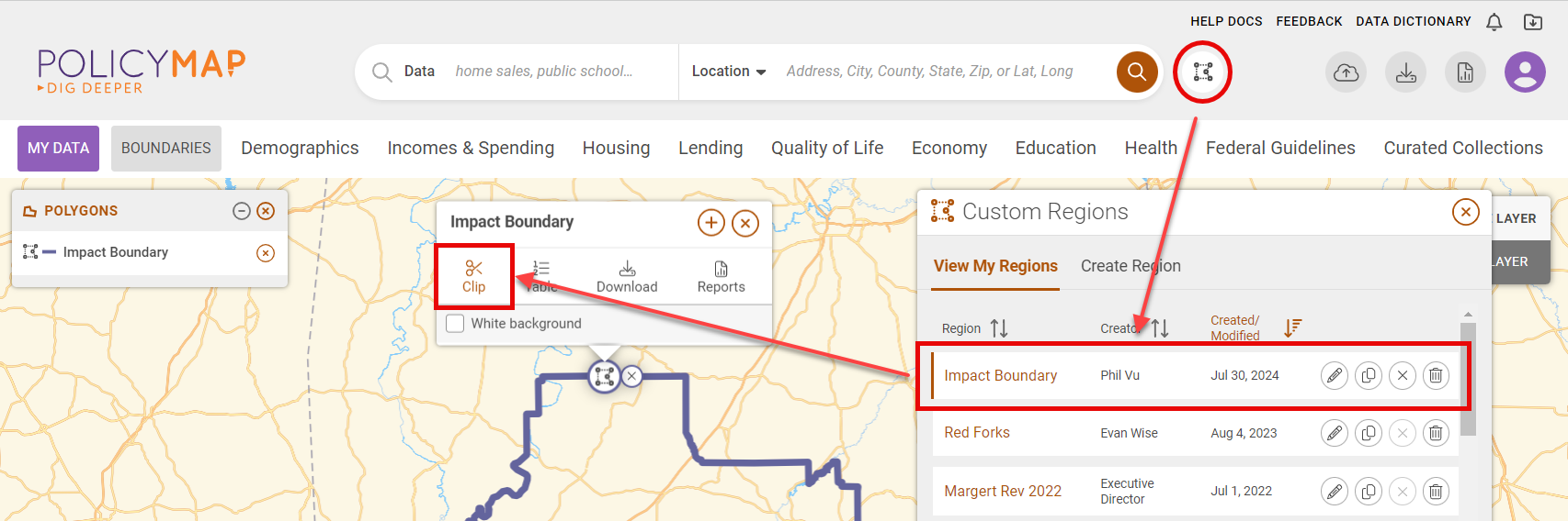
Clip Feature
![]() Updated
by
PolicyMap
Updated
by
PolicyMap
The Clip feature allows users to visually isolate data to a specified location. The map will only show data layers and data points for the clipped location. Use the clip feature in a printout/export also. To use the Clip feature, users will need to specify a location by using:
- the Set Location bar
- or from an already created Custom Region
Once a location is clipped, users can add data layers and data points onto the map. Users can customize the data using the legends, and the data will still only display within the clipped location.
To unclip a location, select the Clip button  on the Info Bubble or the Clip icon
  on the bottom right.
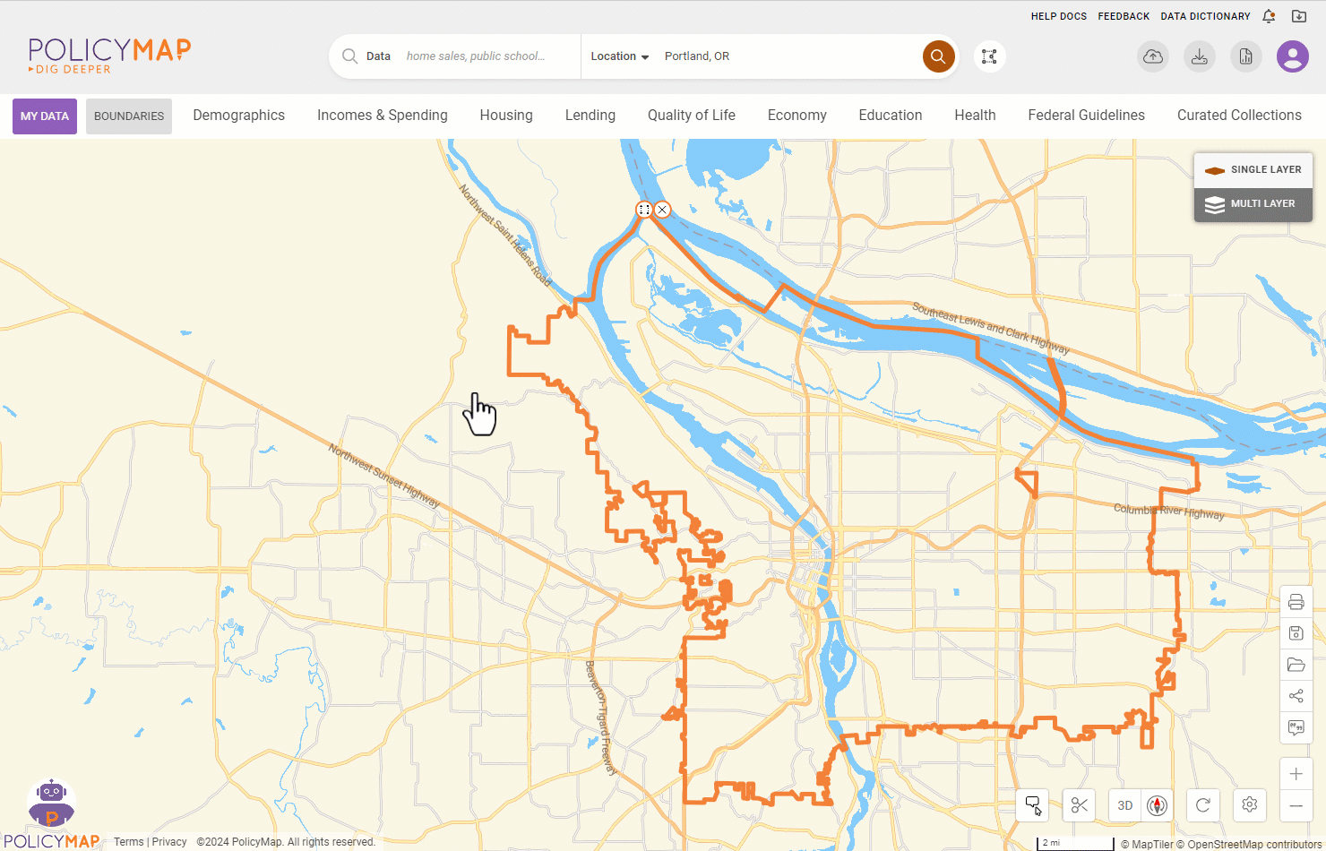
Isolate the clipped area and cover the background in white by selecting the White Background checkbox in the boundary menu or Clip icon on the bottom right.