Map Extent
![]() Updated
by
PolicyMap
Updated
by
PolicyMap
The Map Extent feature allows users to see how data layer ranges are represented locally. The default cut points for ranges are for the national range, while map extent changes the data ranges based on just the area a user is viewing within their window.
To start, users must have a numeric data layer with a range of values loaded. Map Extent is not available for yes/no layers or categorial data layers. Select the Map Extent button in the legend, and the ranges will automatically recalculate based on the data for only the geographies that are showing in the current map window (the extent). This will adjust your color ranges and values they represent in the legend.
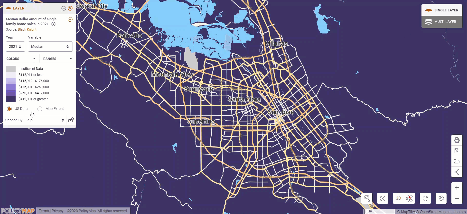
For example, median home sale prices for the San Jose area all fall within the $412,000 or greater range when US Data is selected, due to the very high cost of housing in the Bay Area. If we select the Map Extent, the ranges adjust to show that the zip codes within this area have a minimum home sale value of $708,000 and a maximum of $6,401,500. The new color ranges show that houses in San Jose are $1,200,000 or less while houses in Cupertino and Palo Alto are over $2,499,501.
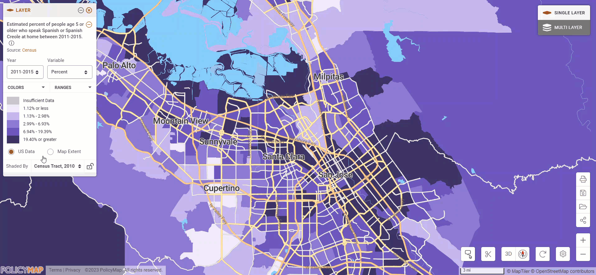
Another example is how many persons speak Spanish at home in the San Jose area. The national range shows that most tracts have more than 1% with a few spots more than 19%. If we select Map Extent, we see that most tracts have more than 4% and many tracts with more than 31% speaking Spanish.
Map Extent can also be used for a defined boundary or custom region. This allows users to see the layer ranges represented just for their location of interest.
To start, search for a place in the Location Bar. Open the Info Bubble for the location and select the Clip button. (please read the guide for Clip to learn more about that feature)
Add a data layer, and the map will show the national range be default but selecting Map Extent will show the range just for the location. This unique view lets users see how the data layer represents the area locally.
The same clip button is available for the custom region info bubble too.